Top Station, Munnar: A Journey Beyond the Clouds
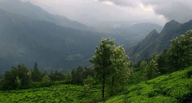
Perched at a dizzying altitude of 1,700 meters (5,577 feet) above sea level, Top Station is more than just a viewpoint; it is a gateway to the heavens. Located approximately 32 kilometers from Munnar town on the border of Kerala and Tamil Nadu, it remains the highest accessible point in the region.
In 2026, Top Station continues to reign as the crown jewel of Idukki’s tourism, offering a surreal experience where travellers can literally "walk among the clouds." As part of the new Munnar.com experience, we invite you to explore the history, the adventure, and the soul-stirring beauty of this iconic destination.
The Historical Legacy: Why is it called "Top Station"?
To understand the significance of this location, one must look back to the early 20th century. During the British colonial era, Top Station served as the uppermost terminal of the Kottagudi Aerial Ropeway and the Kundala Valley Railway.
It was a vital transshipment point for tea produced in the Kannan Devan Hill plantations. Tea chests were transported via rail from Munnar to Top Station, then lowered 5 km downhill via an innovative ropeway system to Kurangani in Tamil Nadu, before being sent to the port of Tuticorin. While the Great Flood of 1924 destroyed much of this infrastructure, the name "Top Station" survives as a tribute to its role as the "topmost" station of this historic logistics network.
Geographic Significance: Two States, One View
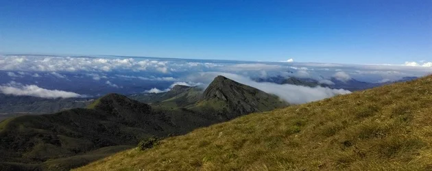
Top Station occupies a unique geographic position on the crest of the Kannan Devan Hills. Standing at the edge of the viewpoint, you are physically in Kerala, but the panoramic vista before you belongs to the Theni District of Tamil Nadu.
On a clear day, the steep cliffs offer an unobstructed view of the Vaigai Dam and the distant plains of South India. This "border-less" beauty makes it a symbolic bridge between the two states, drawing diverse cultures and travellers to its peaks.
Key Attractions and Tourism Activities
The 360-Degree Viewpoint
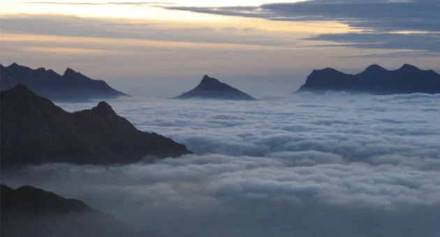
The primary draw is the viewpoint itself. To reach the very edge, visitors descend a series of well-maintained steps. In 2026, we recommend visiting during the "Golden Hour" (between 6:00 AM and 7:30 AM). Watching the sun rise over the mist-filled valley is a spiritual experience that remains the most photographed event in Munnar.The Neelakurinji Phenomenon
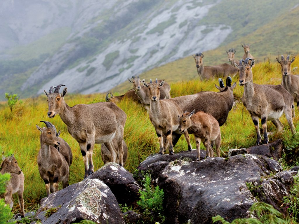
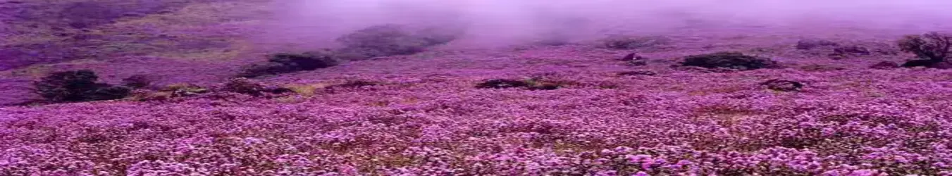
Top Station is the natural habitat of the rare Neelakurinji (Strobilanthes kunthiana). This miraculous shrub blooms only once every 12 years, carpeting the hillsides in a vibrant sea of purplish-blue. While the last mass bloom occurred in 2018, the ecosystem is carefully preserved for the upcoming cycles. In 2026, travellers can still witness the unique shola-grassland vegetation that supports this rare flora.High-Altitude Trekking
For adventure enthusiasts, Top Station is the trailhead for some of South India's most exhilarating treks.The Kurangani Trek: A challenging 12-km descent (or ascent) that connects Top Station to the Kurangani village. This trail takes you through dense shola forests and steep grasslands.
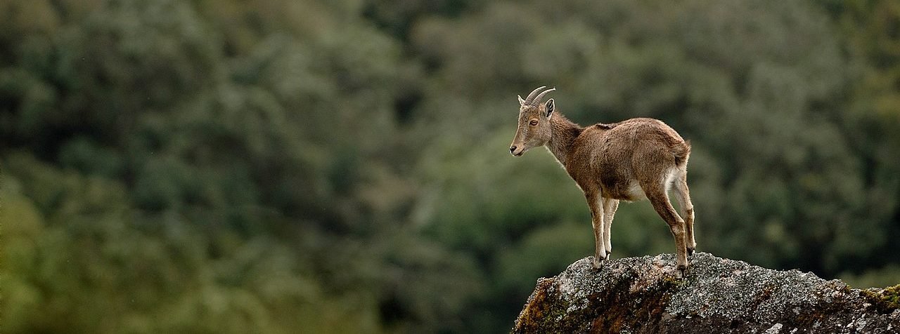
The Border Hike: A moderate ridge-walk that offers perspectives of both the Palani Hills Wildlife Sanctuary and the Munnar valley.
Camping and Stargazing
The rise of Sustainable Glamping in 2026 has made Top Station a hub for overnight stays. Several "Green-Tag" certified campsites offer weather-proof tents and bonfire setups. Due to the lack of light pollution at this altitude, the night sky transforms into a dazzling display of the Milky Way, making it a paradise for astrophotography’s.
The 2026 Travel Guide: Planning Your Visit
Best Time to Visit
September to March (Peak Season): The air is crisp, and the visibility is at its maximum. This is the best time for trekking and camping.
April to May (Summer): A perfect escape from the heat of the plains. Temperatures at Top Station rarely exceed 25 degree Celsius.
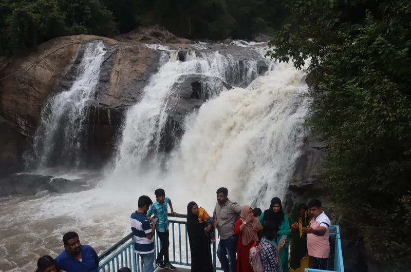
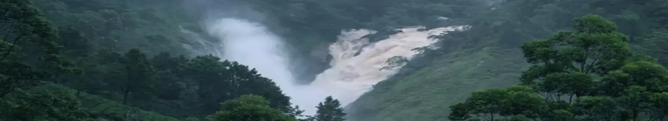
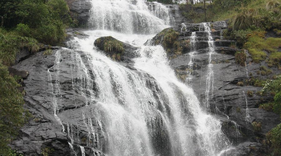
June to August (Monsoon): Only for the brave. While the road journey is risky due to mists, the sight of the roaring waterfalls along the highway is breath-taking.
How to Reach
By Road: A 1.5-hour drive from Munnar town. The route passes through Mattupetty Dam, Echo Point, and Kundala Lake.
By Air: The nearest airport is Cochin International Airport (COK), roughly 140 km away.
By Rail: The closest stations are Aluva and Ernakulam.
Essential Travel Tips
Entry Fees: A nominal fee is collected by the local authorities for maintenance and plastic-waste management.
Clothing: Even in summer, the temperature can drop quickly. Always carry a light jacket or sweater.
Sustainable Travel: As of 2026, Top Station is a strict No-Plastic Zone. Ensure you carry reusable water bottles.
Early Arrival: To avoid the midday crowds and catch the best views, try to reach the viewpoint by 6:00 AM.
Nearby Sightseeing: The "Top Station Circuit"
A trip to Top Station is typically combined with other iconic spots along the Munnar-Kodaikanal road:
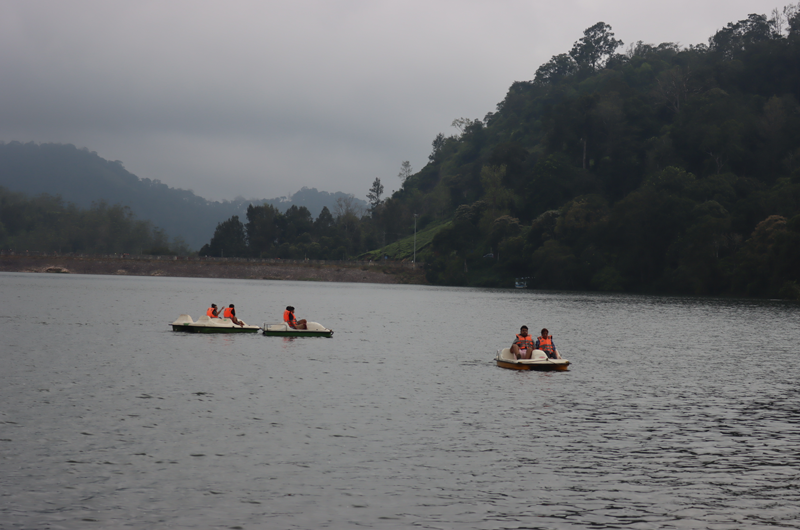
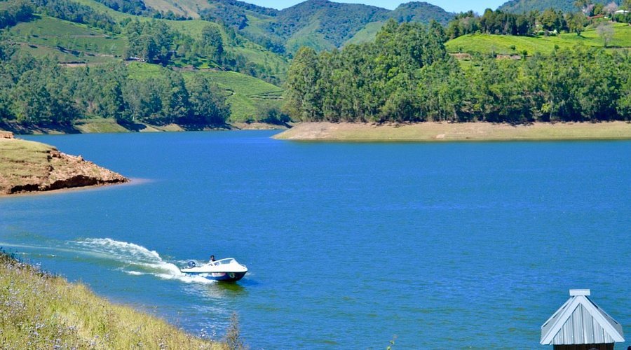
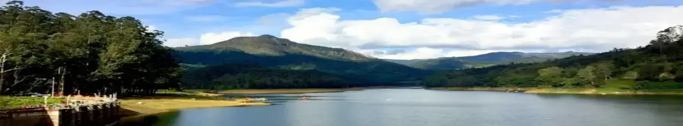
Kundala Lake ( 9 km away): Famous for pedal boating and the rare Cherry Blossom trees that bloom twice a year.
Echo Point (15 km away): A natural acoustic phenomenon where your voice resonates through the mountains.
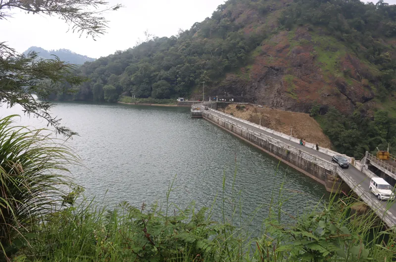
Mattupetty Dam ( km away): A popular spot for speed-boating and elephant sightings.
Why Book Through Munnar.com?
Munnar.com is the digital face of Kerala.com Travel Division, a unit of Worldviewer Dot Com India Pvt Ltd. As an Accredited Tour Operator by the Department of Tourism, Govt of Kerala, we provide a layer of trust and security that unorganized platforms cannot match.
When you plan your Top Station journey with us, you benefit from:
Verified Local Guides: Experts who know the safest trekking paths and hidden viewpoints.
Transparent Logistics: Fixed rates for 4x4 Jeep Safaris and transportation.
Government-Backed Quality: Our accreditation ensures that your holiday adheres to the highest standards of safety and ethics.